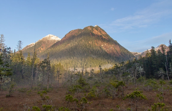
With sunshine in the forecast, it seemed like a good day to get out.
I considered going up a hill, but ultimately decided to head up Indian River valley with a replacement ibutton (temperature datalog). I bought my first batch of ibuttons and started deploying them about 10 years ago. The batteries are supposed to last about 10 years, so I suspect I’ll see a number of additional failures in the coming months.
Rowan and I started out after lunch, and with the sun now setting around 3:30pm, we kept a pretty good pace in order to minimize the chance of coming back in the dark.
I’ve fallen off the routine of getting up hills over the past month, with my outside primarily devoted to looking at and for rare birds instead. Fortunately, Indian River trail is relatively easy to travel, and I made it up to the first bridge without any trouble.
For the off trail portion, I opted to take us along well-worn trail (probably regularly used by hunters this fall) that ran along the west fork. Usually we go along the falls fork, but I was hoping to avoid some of the muddy sections getting into the muskeg, and thought there was a chance of finding a different way in.
Before we had gone too far up this way, I had Rowan go in front and asked her to lead me to the muskeg. She ended up taking us almost directly to our regular path in, but since I only needed to visit the muskeg ibutton, we took a variation that more easily allowed for moving around the edges of the mud holes.
Upon reaching the muskeg, my shoes were still relatively dry, so I opted to walk barefoot. It turned out the water in the muskeg was quite cold, and my feet became uncomfortably chilled while walking. However, as I’ve experienced previously, when I stopped, my feet would warm up (well – probably not actually get warm, but they didn’t feel uncomfortable anymore).
Deciding that stepping around the mud holes was too much effort, Rowan led us back yet another variation. This one had less mud but more brush. Walking barefoot, I would have preferred the mud, but I made it through mostly unscathed and put my shoes back on in the forest. (As it turned out, my shoes and feet ended up getting soaked later on, as a foot slipped off a root into a puddle on the trail, and catching myself with my other foot landed it in the water as well.)
With snow down to 2500 feet or so, I was curious to check the water temperatures in the falls fork and west fork. For the first time (I started measuring in the summer), the falls fork (42F) was cooler than the west fork (44F). The falls fork was down 10 degrees or so from the warmest I measured it last summer, and the west fork was only down about 1 degree from its summer temperature. If we get a cold snap, I’ll definitely want to head back up there again and see what the temperatures are.
On the way back, I wanted to stop by the bench in the bench muskeg. I reflected with Rowan on how much the muskeg in the immediate vicinity of the bench has become torn up and turned to mud. While people walking into the muskeg have no doubt contributed, my suspicion is it’s mostly due to dogs.
The air temperature up at the bridges had registered 39F, and I suspect it was similar at the bench muskeg, though I didn’t measure. I was interested to notice that ice was already forming on the boardwalk spur leading to the bench With the surface exposed to clear skies above, and the sun basically down, I guess it doesn’t take long for it to freeze, especially when the air temperature is getting down towards freezing.
This evening Rowan and I went downtown to checkout the fall gallery art walk. I didn’t think about the clear skies and the nearly full moon, but ended up wishing I had brought my camera and taken some time to get some photos of the moon coming up over Verstovia.


